

Visual research
Building an Axolotl Habitat Cross-Section Without Inventing the Evidence
A source-led account of how a Xochimilco canal habitat schematic was kept honest about what it shows.
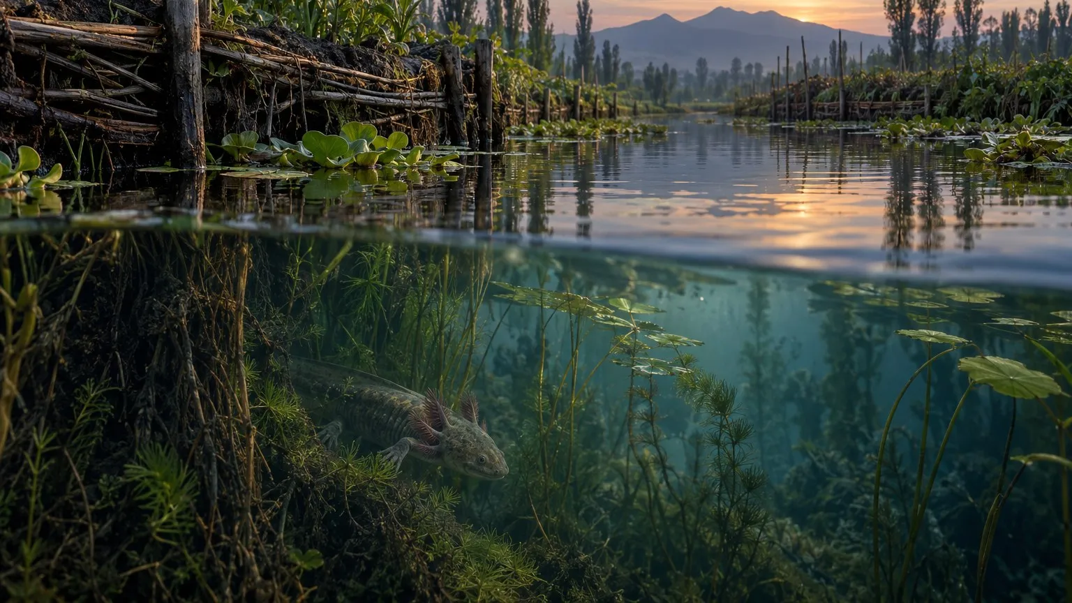
The section cuts through a place
“Cross-section” can mean an internal anatomy plate or a cutaway through a place. The finished artifact is the second kind. It cuts through a Xochimilco canal edge: chinampa structure and plants above the waterline, refuge vegetation below it, and an axolotl occupying that habitat. Calling it anatomy would promise structures the sources and image do not establish.
The Axolotl field guide uses both an atmospheric canal reconstruction and a simpler labelled section. The article hero is a crop of the reconstruction. The schematic below removes the horizon and most of the vegetation detail to make the bank, water, cover, and animal easier to distinguish.
What the sources support
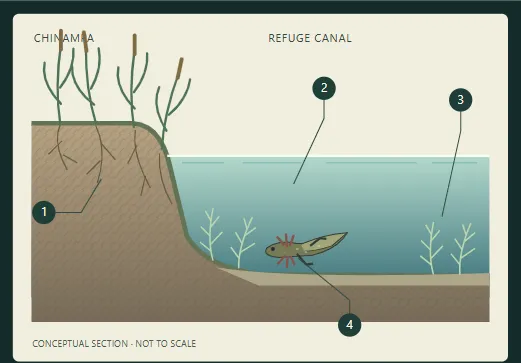
Screenshot of the field guide’s current habitat schematic. The drawing is labelled conceptual and not to scale. Numbers connect the soil, water, vegetation, and animal to the guide’s explanation.
The field guide’s source trail uses the IUCN assessment and CONABIO material for the broad setting and pressures. Those anchors support discussing the canal habitat. They do not supply the coordinates, depth measurements, or plant spacing needed for a surveyed section. The implementation record describes the diagram as an interpretive reading aid and explicitly excludes maps, range polygons, and documentary imagery.
That boundary determines how to read the drawing. The bank has one simplified slope. The water is shown as a continuous blue-green block. The small axolotl establishes the subject without providing a body-length ruler. None of these shapes supplies a distance or a measurement.
Simplification is part of the claim
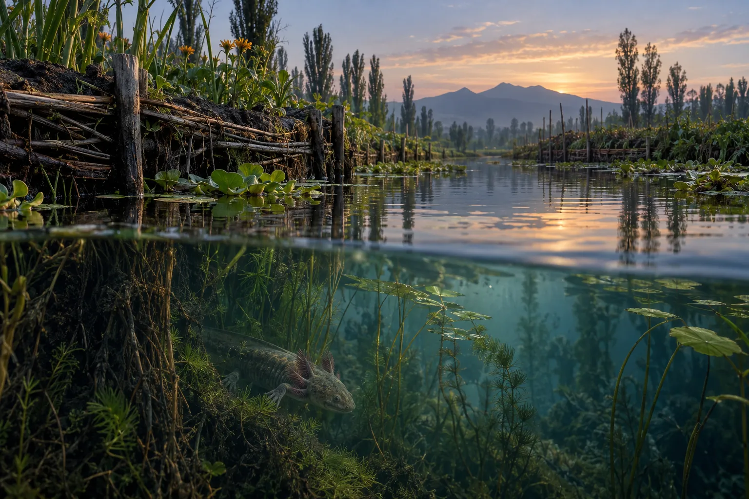
The full AI-assisted editorial reconstruction used for the hero crop. This is a second way to explain the setting, not an earlier measured version of the schematic.
The schematic’s pale horizontal waterline separates the open air from the water column. Thin branching marks stand in for plants. Four numbered leaders carry the explanation without placing paragraphs across the water. The axolotl is a small flat shape rather than a textured portrait. Together, those choices keep the relationships readable when the figure shrinks on a phone.
The atmospheric reconstruction does a different job. It shows an above-and-below-water scene with vegetation, a horizon, reflected light, and a much more detailed animal. The reader can imagine the setting, but should not infer that the image records a field visit. The figure’s commissioned-art provenance and reconstruction disclosure are therefore part of the explanation, not a footnote about software.
The two images are presented as complementary views, not a fabricated before-and-after. The project record supports why the schematic was introduced and what it was meant to explain. It does not identify a rejected earlier canal drawing, so there is no failed version in this article.
The useful limitation
A good educational diagram tells the reader where its certainty ends. This one explains a habitat relationship and points back to the field guide for species context. It does not document a particular canal survey, prove restoration outcomes, or replace the cited assessments. That boundary makes the visual more useful, because the reader can see which decisions are evidence-led and which are editorial interpretation.
For broader methods and provenance, continue to Sources & methods.
Sources used in this note
- Ambystoma mexicanum assessment · IUCN Red List Species status and habitat context.
- Ajolote and Xochimilco conservation resources · CONABIO Canal and conservation context.
Related notes
Print engineering
Why a Good Blender Sculpt Can Still Make a Bad 3D Print
What the axolotl and Philippine eagle records show about geometry, scale, supports, and the boundary between digital checks and physical printing.